Rainwater Harvesting Resources
Designing a rainwater harvesting system starts with understanding your roof size, water demand, and local rainfall. Every property is different, and the amount of water you can collect depends largely on how much rain your area receives throughout the year.
This page provides helpful resources about rainwater harvesting systems and links to rainfall data across Texas. The rainfall maps allow you to explore historical and current weather patterns so you can better understand the water potential for your property.
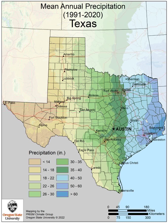
PRISM Climate Group (Oregon State University) provides detailed climate and weather data across the United States. Their maps and tools show historical and current patterns for rainfall, temperature, drought conditions, and other climate variables. Using decades of weather station data combined with advanced modeling, PRISM creates highly accurate maps that help people understand how climate varies across regions.
Visit their site for more details on past weather patterns.
https://prism.oregonstate.edu/normals/
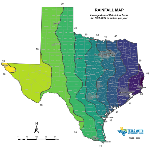
The map below shows the prior decade of annual rain fall in Texas.

Texas is one of only a few states in the nation that has devoted a considerable amount of attention to rainwater harvesting and has enacted many laws regulating the practice of collecting rainwater.
Visit their site for more details:
https://www.twdb.texas.gov/innovativewater/rainwater/index.asp